Wednesday, August 1, 2018

Rainfall Toppers in South West Monsoon 2018, Talacauvery rocks this Monsoon - Rainfall from 01.06.2018 to 31.07.2018

(in mm & min 4000 mm)

1. Talacauvery, Karanataka - 5580
2. Agumbe, Karnataka - 5086
3. Yadur, Karnataka - 4975
4. Hulikal, Karnataka - 4777
5. Shirgaon Ghat, Maharashtra - 4690
6. Masitkatte, Karnataka - 4654
7. Tamhini Ghat, Maharashtra - 4620
8. Kuttiyadi, Kerala - 4613
9. Gavali, Karnataka - 4539 
10. Lamaj, Maharashtra - 4534
11. Patherpunj, Maharashtra - 4474
12. Kitwade, Maharashtra - 4282
13. Varahi, Karnataka - 4264
14. Dabbaedka, Karnataka - 4225
15. Dawadi Ghat, Maharashtra - 4210
16. Kollur, Karnataka - 4210
17. Amboli, Maharashtra - 4122
18. Anasi, Karnataka - 4098
19. Bhagamandala - 4038

Cherrapunji is lagging way behind with a rainfall of 3681 mm.

Metropolitan Cities minimum 3 million population - Rainfall from 01.06.2018 to 31.07.2018
------------------
in mm

1.Mumbai - 1931
2.Surat - 1038
3.Kolkata - 718
4.Delhi - 326
5.Pune - 303
6.Jaipur - 248
7.Hyderabad - 193
8.Chennai* - 180
9.Bangalore - 176
10.Ahmedabad - 152

* Chennai monsoon starts from October

Tamil Nadu Major Cities Rainfall from 01.06.2018 to 31.07.2018
------------------
in mm

1.Salem - 369
2.Chennai - 180
3.Trichy - 116
4.Coimbatore - 77
5.Madurai - 68

Karnataka Top 5 Rainfall places from 01.06.2018 to 31.07.2018
------------------
1. Talacauvery - 5580
2. Agumbe - 5086
3. Yadur - 4975
4. Hulikal - 4777
5. Mastikatte - 4654

Maharashtra Top 5 Rainfall places from 01.06.2018 to 31.07.2018
------------------
1. Shirgaon Ghat - 4690
2. Tamhini Ghat - 4620
3. Lamaj - 4534
4. Patherpunj - 4474
5. Kitwade - 4282

Kerala Top 5 Rainfall places from 01.06.2018 to 31.07.2018
------------------
1. Kuttiyadi - 4613
2. Pambla Dam - 3745
3. Thariode - 3312
4. Kakki - 3058
5. Ponmudi - 2909

Tamil Nadu Top 5 Rainfall places from 01.06.2018 to 31.07.2018
------------------
1. Chinna Kallar, Coimbatore - 2946
2. Peria Kallar, Coimbatore - 2719
3. Sholayar Dam, Coimbatore - 2673
4. Avalanche, Nilgiris - 2520
5. Upper Bhavani, Nilgiris - 2448

Goa Top 5 Rainfall places from 01.06.2018 to 31.07.2018
------------------
1. Valpoi - 2494
2. Pernem - 2112
3. Ponda - 2066
4. Sanguem - 2039
5. Ela - 2002

Wednesday, March 14, 2018

First 200 mm rainfall of the year in India recorded in Thoothukudi as it breaks its all time heaviest 24hrs rainfall ever with 200 mm in just few hours beating the one day rainfall record set on 3rd December 1955, with 188 mm rainfall

Thanks to the Depression near Comorin - Lakshwadeep Sea, the first 200 mm rainfall of India in 2018 has been recorded. The rainfall recorded in Tamil Nadu in mm ending 8.30 am on 14.03.2018 are as follows. (min 20 mm) Thoothukudi District ------------------ Thoothukudi - 200 Kayalpattinam - 142 Srivaikuntam - 95 Tiruchendur - 82 Vaippar - 56 Keelaarsaradi - 54 Ottapidaram - 52 Ettayapuram - 49 Kayathar - 48 Kadambur - 45 Maniyachi - 40 Vilathikulam - 40 Surangudi - 38 Satankulam - 36 Vedanatham - 32 Tirunelveli District ----------------- Papanasam Dam - 190 Lower Papanasam - 146 Ramanadhi Dam - 130 Gadana Dam - 110 Servalar Dam - 102 Shencottah - 101 Kallidaikuruchi - 72 Thenkasi - 86 Manimuthar Dam - 68 Ambasamuduram - 67 Valliyoor - 67 Ayikudi - 64 Nanguneri - 60 Kalakadu - 54 Kadayanallur - 50 Cheranmahadevi - 46 Palyamkottai - 45 Keelapavoor - 42 Tirunelveli - 31 Melaneelithanallur - 27 Sankarankoil - 25 Other district such as Dindigul, Kanyakumari, Virudhunagar others too got rains ------------------------------------ Lower Kodayar, Kanyakumari - 50 Kamatchipuram, Dindigul - 42 Mylaudy, Kanyakumari - 35 Kodaikanal Boat Club, Dindigul - 33 Kodaikanal, Dindigul - 31 Suralode, Kanyakumari - 32 Pillavakkal, Virudhunagar - 30 Kanyakumari, Kanyakumari - 29 Thuckalay, Kanyakumari - 27 Srivilliputtur, Virudhunagar - 25 Thiruppathisaram, Kanyakumari - 23 Upper Kodayar, Kanyakumari - 23 Kottaram, Kanyakumari - 22 Kuzhithurai, Kanyakumari - 22 Perunchani, Kanyakumari - 22 Kundha Bridge, Nilgiris - 21 Nagercoil, Kanyakumari - 20 Manjalar, Theni - 20 Mulanur, Tiruppur - 20 S.Pudur, Sivaganga - 20 Dharapuram, Tiruppur - 20 Aravakuruchi, Karur - 20

Tuesday, October 11, 2016


Massive Rains in Uttara Kannada district in Karnataka


Not often you will see 300 mm rainfall in 24 hrs in Karnataka in October 2nd week. This is one was such a freak heavy rainfall. most of the heavy rains happened in Ankola Taluk in Uttara Kannada district in Northern Karnataka.


Water from Karanja Dam released after 6 years


The last time water was released from the reservoir was in 2010. Karanja which has the capacity to store 6.9 TMC of water. Water being released fron the Karanja Dam in Bidar following heavy inflow in the past few days (Photo Courtesy: DC)


Tuesday, August 9, 2016

All India SWM toppers 70 days into the Monsoon


Legendary Rainfall in past 8 days in Kitwade

Kitwade is located 10 kms from Amboli Hill Station in Sindhudurg-Kolhapur district in Ajara Taluk and i have been tracking its daily rainfall for over 8 years now. Hopefully, i visit this along with Amboli in future. Not many stations can record rainfall like this except (Mawsynram and Cherrapunji in the whole world)

in mm (24 hrs rainfall)


09.08.2016 - 220
08.08.2016 - 451
07.08.2016 - 341
06.08.2016 - 528
05.08.2016 - 416
04.08.2016 - 400
03.08.2016 - 295
02.08.2016 - 227
--------------------
Total - 2878 mm
--------------------

Sunday, July 17, 2016

Earthquakes and what one needs to know - Tamil Nadu Weatherman Special

I am not a Geologist and whatever i tried to compile here is from various sources and is done of personal capacity. For some years now, like rainfall i have been collecting data on earthquakes. I have some fair idea of them. Please dont reply who are you to put this update like last time. People need to know what earthquakes have hit Tamil Nadu in the past and intensity. This update is put based on request and also the recent news that an major Earthquake is expected in North East India has created a major interest among public about earthquakes. I have tried to keep as simple as possbile without and technical explanations.

What causes earthquakes to happen and Where the Major Plates and Minor Plates in world ?

Movement of the plates and their collision causes earthquakes. Of course, this is true in the larger perspective and the earthquake occurrences in Indian plate boundaries like Himalayan belts, Kashmir, Gujarat, North East India and Andaman Islands can be explained. But as far as south India and Tamil Nadu is concerned, all the earthquakes have not occurred in plate boundaries because we are not in fault lines, but only within a plate and hence it doesnot mean earth quakes will occur only at fault lines, that idealogy should be changed. But yes major and frequent earthquakes occur only in the fault lines where two plates collide. The major plates in the world is posted below and you can wonder why Himalayas,  Kashmir, Gujarat, North East and Andaman get frequent earthquakes.
Major Plates in the World
The Indian plate has some minor plates and no wonder the Andaman - Indonesia belt gets some daily earthquakes due to a small micro plate called the Burma Plate at one point three plates meet near Indonesia.

Indian Plate and the Micro Burma Plate

 Does Earthquake Occur only in Fault Lines or along the edges of plates ?

An intraplate earthquake occurs in the interior of a tectonic plate.  Intraplate earthquakes are relatively rare. Interplate earthquakes, which occur at plate boundaries, are more common. Nonetheless, very large intraplate earthquakes can inflict heavy damage, particularly because such areas are not accustomed to earthquakes and buildings are usually not seismically retrofitted. Examples of damaging intraplate earthquakes are the devastating Gujarat earthquake in Bhuj in 2001 and 1993 Lattur earthquake in Maharashtra. The strong Intraplate Earthquakes like 2001 and 1993 are very very rare, though lesser intensity quakes occur occasionaly. Here is the sesmic zone map of India and you can see most of Zone 4 and 5 high risk areas falls along the fault lines.

Chennai and Coimbatore falls under Zone 3 of moderate risk from Earthquake

Historical Earthquakes in Last 200 years in Indian Region

The Indian subcontinent has a history of earthquakes. The reason for the intensity and high frequency of earthquakes is the Indian plate driving into Asia at a rate of approximately 49 mm/year. The following is a list of major earthquakes which have occurred in India.


Now lets come to Tsunami and what type of Earthquake causes it ?

Tsunami can be generated when the sea floor abruptly deforms and vertically displaces the overlying water. A tsunami can be generated when thrust faults associated with convergent or destructive plate boundaries move abruptly, resulting in water displacement, owing to the vertical component of movement involved. Tsunamis have a small amplitude (wave height) offshore, and a very long wavelength (often hundreds of kilometres long, whereas normal ocean waves have a wavelength of only 30 or 40 metres), which is why they generally pass unnoticed at sea, forming only a slight swell usually about 300 millimetres (12 in) above the normal sea surface. They grow in height when they reach shallower water, in a wave shoaling process described below. A tsunami can occur in any tidal state and even at low tide can still inundate coastal areas.

In India Region

Tsunamis usually are associated with dip-slip type earthquakes rather than with strike-slip type earthquakes. The earthquakes in the Andaman region are associated mainly with strike-slip type of faulting. It is believed that these events probably occur along the north-south trending West Andaman fault.  Upto the 26 December 2004, the earthquake of 26 June 1941 had been the strongest ever recorded in the Andaman and Nicobar Islands, in generating a destructive tsunami. The 1941 event was the last great earthquake in the Andaman and Nicobar Islands. The 1881 Nicobar Islands earthquake was the only other event of comparable magnitude.
Strike-slip faults indicate rocks are sliding past each other horizontally, with little to no vertical movement. Both the San Andreas and Anatolian Faults are strike-slip.

Dip-slip Normal faults create space. Two blocks of crust pull apart, stretching the crust into a valley. The Basin and Range Province in North America and the East African Rift Zone are two well-known regions where normal faults are spreading apart Earth's crust.

Dip-slip Reverse faults, also called thrust faults, slide one block of crust on top of another. These faults are commonly found in collisions zones, where tectonic plates push up mountain ranges such as the Himalayas and the Rocky Mountains.
 

Historic Tsunamis in India in last 250 years

Tsunami is new in India. Sad that our Geography books did not teach us anything about Tsunami prior to 2004 event. I have compiled some of the tsunami events which affected the Indian coast in the last 250 years.

 
Based on these statistical and historical information, it can be concluded that most of the earthquakes in the Andaman Sea Basin do not usually generate significant tsunamis with the possible reason for the low number of tsunamis is that most of the earthquakes in the Andaman Basin are mainly associated with strike-slip type of faulting.

However, Earthquakes with magnitude 8.0 or greater (such at the 1941 and 2004 events) associated with "dip-slip" types of vertical crustal displacements along thrust faults have the potential of generating very destructive tsunamis in the entire Bay of Bengal Region the Andaman Sea and the Indian Ocean.

Earthquakes with epicenter in Tamil Nadu

GSHAP or the Global Seismic Hazard Assessment Program has prepared the Global maps for sesmic activity. Coimbatore and Nilgiris fall in moderate hazzard zone while Chennai and Pondycherry fall in low hazzard zone. Here is the map for India and Tamil Nadu


Source - (ASC-India)
The list of earthquakes which has happened in Tamil Nadu in the last centre is given below. Only epicenter in Tamil Nadu is considered.


The sesmic zones and the places of earthquakes in Tamil Nadu is given below. As you can see only one quake managed to cross 6.0 scale that was in coimbatore


The tremors are sometime felt in Chennai from far away powerful earthquakes and i still remember in the last ones in 2012 and 2009 when we ran out from our offices at T.Nagar


The intensity scales and the level of destruction is given below.


I think you can also tell with stats that there is going to happen a major earthquake within the fault lines of Indian Plate in Northeast / North India along Himalayan belt, when it happens you can claim that you have predicted it. As for as Tamil Nadu is concerned, we fall in intraplate zone. It is impossible and there is not even 1% chance to predict earthquakes here. Only God knows. If someone says there will earthquakes in Tamil Nadu tell them, its impossible. If they say for north east India or Indonesia. Tell them, yeah its in fault line and obviously one big quake is bound to happen now and then.

Source taken from wikipedia, historical books, Asc India, KS Valdiya, Dr.George Pararas-Carayannis

Wednesday, July 13, 2016

All India South West Monsoon Toppers from 01.06.16 to 10.07.2016

It took solid 3 days to compile this from over 10000 stations and some i have to maintain in excel sheet and i feel relieved at last to complete the job. Cherrapunji at 1798 mm, World No.1 wettest place Mawsynaram at 1860 mm, Kitwade at 1805 mm, Mahabaleshwar, Chinnakallar (king of Tamil Nadu), Gaganbawda, Kuttiyadi, Gavali, Amgaon all failed to make the cut-off. Hulikal which is King of South India is not working and Talacauvery readings not available. Open the image in new tab for higher clarity.


Wednesday, October 14, 2015

SWM Toppers from 1.06.2015 to 30.09.2015


Min 4000 mm

1.Mawsynaram, Meghalaya - 11492
2.Cherrapunji RKM, Meghalaya - 10000-10500
3.Cherrapunji, Meghalaya - 10085
4.Hulikal, Karnataka - 5350
5.Mastikatte, Karnataka - 5102
6.Agumbe, Karnataka - 4943
7.Shiragaon, Maharashtra - 4921
8.Lamaj, Maharashtra - 4721
9.Yadur, Karnataka - 4704
10.Mani, Karnataka - 4458
11.Cogar, Karnataka - 4500
12.Talacauvery, Karnataka - 4451
13.Mulshi, Maharahstra - 4391
14.Nilkund, Karnataka - 4200
15.Kuttiyadi, Kerala ~ 4100
16.Walvan, Maharashtra - 4050
17.Patherpunj, Maharashtra - 4000
18.Kollur, Karnataka ~ 4000
19.Kerekatte, Karnataka - 4000 (till 31.08.2015)

Wednesday, September 23, 2015


Vamco pulse which is a LPA now, pounds Meghalaya with extreme rainfall ending 8.30 am on 23.09.2015

The low pressure area lies over north Bangladesh and neighbourhood and the associated cyclonic circulation extends upto 2.1 kms a.s.l.

in mm

Mawsynram - 422
Cherrapunji RKM - 368
Cherrapunji - 308
Williamnagar - 230
Nongstion - 174
Shella - 120
Barapani - 80
Shillong - 77
Jowai - 60
Nongpoh - 30


Himachal gets heavy rains from interaction of Dying LPA and WD, ending 8.30 am on 23.09.2015

The low pressure area over northwest Rajasthan and neigh bourhood has become less marked. However, associated cyclonic circulation lies over Haryana and adjoining Punjab and extends between 1.5 & 2.1 kms a.s.l. The western disturbance as an upper air cyclonic circulation extending upto 5.8 kms a.s.l. lies over north Pakistan and neighbourhood with a trough aloft now running roughly along Long.71.0°E to the north of Lat.25.0°N. 

in mm

Kheri - 168
Dalhousie - 149
Kalatop - 147
Aghar - 142
Ghamroor - 97
Dharamshala - 92
Saloni - 82
Amb - 80
Udaipur - 77
Chamba - 77
Nurpur - 72
Gaggal - 69
kangra - 69
Bharwara - 67
Nainadevi - 64
Guler - 64
Bhoranj - 60
Manali - 57
Renuka - 57
Keylong - 51
Una - 50

WD interacts with the dying LPA and its asscoiated circulation, causes massive rains in Kashmir, ending 8.30 am on 23.09.2015

The low pressure area over northwest Rajasthan and neigh bourhood has become less marked. However, associated cyclonic circulation lies over Haryana and adjoining Punjab and extends between 1.5 & 2.1 kms a.s.l. The western disturbance as an upper air cyclonic circulation extending upto 5.8 kms a.s.l. lies over north Pakistan and neighbourhood with a trough aloft now running roughly along Long.71.0°E to the north of Lat.25.0°N. 

in mm

Kathua - 203
Katra  - 192
Batote  - 192
Rajhani - 177
Banihal - 131
Udhampur - 130
Qazigund - 128
Badarwah - 115
Kukernag  - 106
Anantnag - 91
Jammu - 84
Jammu Aero - 80
Rajouri  - 70
Awantipur - 62
Pahalgam - 60
Gulmarg - 58
Govindpura - 57
Samba - 50
Kupwara - 45

Dying LPA and WD pounds food bowl of India (Punjab) with massive rains, ending 8.30 am on 23.09.2015
The low pressure area over northwest Rajasthan and neigh bourhood has become less marked. However, associated cyclonic circulation lies over Haryana and adjoining Punjab and extends between 1.5 & 2.1 kms a.s.l. The western disturbance as an upper air cyclonic circulation extending upto 5.8 kms a.s.l. lies over north Pakistan and neighbourhood with a trough aloft now running roughly along Long.71.0°E to the north of Lat.25.0°N.

in mm

Malakpur - 216
Madhopur - 200
Mukerian - 192
Hoshiarpur - 190
Gurudaspur - 185
Shahpur Kandi - 170
Phangota - 150
Ranjit sagar dam - 140
Dasuya - 120
Ropar - 108
Chandigarh - 101
Mohali - 100
Kharar - 83
Tibri - 81
Sirhind - 80
Batala - 79
Taran Taran - 76
Nabha - 75
Derabassi - 72
Balachaur - 70
Amritsar - 60
Anandpur Sahib - 60
Nangal - 58
Badikakoran - 57
Nakodar - 55
Samrala - 54
Kapurthala - 53
Fatehgarh Sahib - 52


Monday, September 14, 2015

Top 15 rainfall of SWM 1st June - 12th September, 2015


Min 4000 mm 

1.Mawsynaram, Meghalaya -  10550
2.Cherrapunji, Meghalaya - 9143
3.Cherrapunji RKM, Meghalaya - N.A.
4.Hulikal, Karnataka - 4980
5.Mastikatte, Karnataka - 4791
6.Agumbe, Karnataka - 4624
7.Lamaj, Maharashtra - 4507
8.Yadur, Karnataka - 4473
9.Shiragaon, Maharashtra - 4319
10.Talacauvery, Karnataka - 4257
11.Mani, Karnataka - 4212
12.Kerekatte, Karnataka- 4100
13.Mulshi, Maharashtra - 4004
14.Cogar, Karnataka - 4000
15.Kuttiyadi, Kerala ~ 4000

Wednesday, August 19, 2015

Meghalaya's historic rainfall continues.

Mawsynaram gets close to 2000 mm rainfall in past 4 days. Can it reach 1000 mm in a day


Mawsynaram Last 4 days rainfall

16.08.2015 - 409 mm
17.08.2015 - 198 mm
18.08.2015 - 526 mm
19.08.2015 - 745 mm
-------------------------
Total - 1878 mm
-------------------------

Khliehshnong Last 4 days rainfall

16.08.2015 - 241 mm
17.08.2015 - NA
18.08.2015 -  NA
19.08.2015 - 569 mm
--------------------------
Total - 810 mm (in two days)
-------------------------

Cherrapunji Last 4 days rainfall

16.08.2015 - 195 mm
17.08.2015 - 162 mm
18.08.2015 - 313 mm
19.08.2015 - 472 mm
--------------------------
Total - 1142 mm
-------------------------

Mawkyrwat  Last 4 days rainfall

16.08.2015 - 190 mm
17.08.2015 - 120 mm
18.08.2015 - 383 mm
19.08.2015 - 417 mm
--------------------------
Total - 1110 mm
-------------------------

Friday, July 3, 2015

SWM Toppers is back, Top 20 Rainfall stations in India from 01.06.15 to 30.06.15

Its Mawsynaram and Cherrapunji all the way, none had the chance to catch them. Agumbe has got only 1323 mm and Amboli around 1250 mm is not in the list. The surprise is 2 stations from Tamil Nadu has made into the list it is not Chinnakallar or Devala. Its Parsons Valley and Avalanche from Nilgiris district.

in mm (min 1400 mm)
  1. Mawsynaram, Meghalaya - 4781
  2. Cherrapunji, Meghalaya - 4355
  3. Parsons Valley, Tamil Nadu - 2166
  4. Shiragaon, Maharashtra - 2076
  5. Lamaj, Maharashtra - 2057
  6. Talacauvery, Karnataka - 2033
  7. Naladi, Karanataka - 1910
  8. Hosanagar, Karnataka - 1892
  9. Kottigehara, Karnataka - 1826
  10. Bhagamandala, Karnataka - 1820
  11. Amgaon, Karnataka - 1738
  12. Patherpunj, Maharashtra - 1684
  13. Avalanche, Tamil Nadu - 1663
  14. Tapola, Maharashtra - 1596
  15. Yadur, Karnataka - 1481
  16. Sangave, Maharashtra - 1472
  17. Mulshi, Maharashtra - 1470
  18. Mahabaleshwar, Maharashtra - 1443
  19. Kuttiyadi, Kerala - 1401
  20. Hulikal, Karnataka - 1400
This data is only for Vagaries, Kea Weather and Tamil Nadu Weatherman. I kindly request you to put source of this blog, in case you are trying to copy and paste the above in any other blog or website.

Friday, June 26, 2015

Deep Depression Leaves trail of Destruction in Gujarat with Historic Rainfall and leaves over 70 dead.


The Deep Depression made landfall over south Gujarat coast near Diu on 23rd June 2015 and dumped historic rainfal. Amreli district was the worst hit. Bagasra got its annual rainfall in one day. 

in mm

24.06.2015

Una - 324
Gir Gadhada - 288
Malia  - 269
Kodinar  - 225
Talala - 219
Rajula - 192
Diu  - 189
Rajkot  - 167


25.06.2015

Bagasra - 636
Dhari - 511
Variyav - 400
Vadia - 393
Gondal - 257
Lodhika  - 252
Palitana - 251
Wanakbori - 245
Kotdasangani  - 237
Malpur - 216
Vadali - 200
Shahera - 194
Bhiloda - 190
Khedbrahma - 189
Godhra - 184
Lathi  - 182
Amreli - 182
Bhavnagar - 182
Savarkundla - 180
Jessar - 180
Idar - 177
Surat - 177
Vallabhipur - 177
Umrala  - 164
Meghraj - 161


Saturday, June 13, 2015

Cyclone Ashoba weakens into Low Pressure Area, No landfall as a Storm.

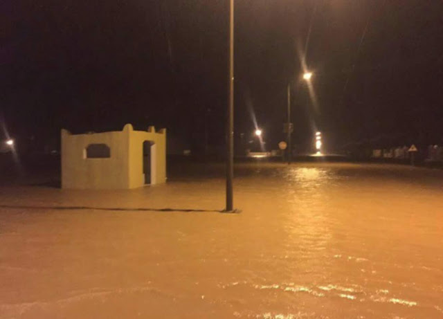
As predicted a week back the deep layered HPA and unfavorable conditions will not allow it for landfall over Oman, and Ashoba will fizzle out in Open Sea. The same has happened yesterday. Ashoba had weakened from Depression to Low Pressure Area on 12th evening. It is no more a Cyclone. But now comes the flooding.


Here are the rainfall in Oman, which are historic Masirah has got 236 mm rainfall in last two days

in mm

13.06.2015
--------------
Masirah - 170
Joba - 89
Sur - 53
Qalhat - 42
Bydiah - 8
Ras Al-Had - 6
Qurn Alam - 4
Yaaloni - 3

12.06.2015
--------------
Masirah - 66

Ras Al-Had - 40
Sur - 19
Qalhat - 7
Joba - 3
Bydiah - 4